M 7.6 Earthquake Strikes the Philippines: What If a Tsunami Reaches Indonesia?
A powerful magnitude 7.6 earthquake struck Mindanao, the Philippines, on Friday night, October 10, 2025, triggering tsunami warnings across the region, including North Sulawesi and Papua, Indonesia.
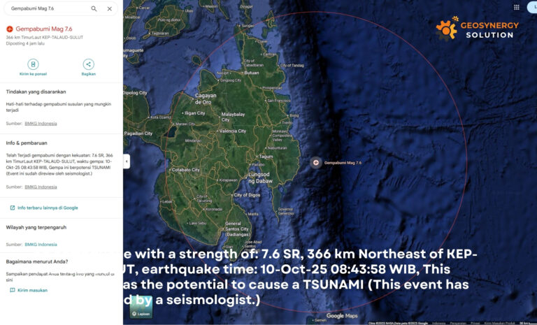
The quake occurred at 7.34°N, 126.87°E, approximately 287 kilometers northwest of Karatung Island, North Sulawesi, at a depth of 56 kilometers, according to the Indonesian Meteorology, Climatology, and Geophysics Agency (BMKG).
Residents in Tahuna reported shaking intensity of IV MMI, while Manado experienced around II MMI.
BMKG immediately issued an early tsunami warning for several eastern Indonesian regions, urging residents to stay alert and follow official instructions.
Potential Tsunami Impact on Indonesia
Based on BMKG’s tsunami modeling, waves with a maximum height of 50 cm could potentially reach the following areas:
North Sulawesi, Talaud Islands — ETA: 10-10-2025, 09:59:58 WITA
North Sulawesi, Bitung City — ETA: 10-10-2025, 10:49:13 WITA
North Sulawesi, South Minahasa — ETA: 10-10-2025, 11:02:13 WITA
North Sulawesi, South Minahasa Utara — ETA: 10-10-2025, 11:01:28 WITA
Papua, Supiori — ETA: 10-10-2025, 12:26:43 WIT
“Tsunami early warning in North Sulawesi and Papua,” BMKG stated in its official bulletin.
Fortunately, as of the latest report, no significant tsunami had been recorded, though authorities continue to monitor sea-level changes closely.
Understanding the Earthquake and Regional Tectonics
This earthquake occurred within the Philippine Sea Plate, near its subduction boundary with the Eurasian Plate. The region is part of the Pacific Ring of Fire, one of the world’s most active seismic zones.
Such large earthquakes can displace seabed sediments, generating tsunami waves that travel rapidly across ocean basins — often reaching Indonesia’s eastern coastlines within an hour.
Related article: Freeport Underground Mine Accident Victims Identities Confirmed
What Could Happen If the Tsunami Reaches Indonesia?
If tsunami waves reach North Sulawesi or Papua, the potential impacts include:
Coastal flooding in low-lying areas.
Strong wave currents endangering small boats and ports.
Temporary disruption to local infrastructure and fishing activities.
BMKG and BASARNAS continue to coordinate with PHIVOLCS (Philippine Institute of Volcanology and Seismology) to monitor any changes in wave activity and to ensure public safety.
“We urge the public to remain calm and stay informed through verified government channels,” said BMKG spokesperson Dwikorita Karnawati.
Learning from Past Disasters
Both the Philippines and Indonesia have faced destructive earthquakes and tsunamis before — including the 2004 Indian Ocean tsunami and the 2018 Palu earthquake. These events underline the importance of public awareness, early warning systems, and community evacuation readiness.
Geological experts from BRIN (National Research and Innovation Agency) highlight that cross-border cooperation in monitoring and mitigation is essential to reduce risks in the future.
Preparedness Recommendations
To stay safe during and after strong earthquakes:
Follow official tsunami evacuation routes in your area.
Move to higher ground immediately after a strong tremor.
Avoid spreading rumors and rely on verified updates from BMKG.
Participate in community disaster drills for better readiness.
The M 7.6 earthquake in Mindanao, Philippines, reminds us that both nations share geological vulnerabilities under the Pacific Ring of Fire.
Strengthening early warning systems, improving communication, and promoting public education remain vital steps to protect communities from future disasters.